Periyar River is the longest river in Kerala and one of the most historically, culturally, and ecologically significant rivers in South India. Flowing through the lush landscapes of the Western Ghats and eventually merging with the Arabian Sea, the Periyar River sustains millions of people and supports agriculture, hydroelectric power, wildlife ecosystems, and tourism.
Stretching approximately 244 kilometers, the river originates in the Western Ghats near Sivagiri Hills and flows through districts such as Idukki, Ernakulam, and Thrissur before draining into the Vembanad Lake system.
Periyar is more than a river — it is the economic backbone and ecological heart of Kerala.
Origin and Course of the River
The Periyar River originates in the forested hills of the Western Ghats at an elevation of around 1,800 meters. It flows northward and then westward, passing through deep valleys, dense forests, wildlife sanctuaries, and fertile plains.
Major tributaries include:
- Mullayar
- Cheruthoni
- Perinjankutti
- Edamalayar
One of the most significant landmarks along its course is the Idukki Dam, a major hydroelectric project that contributes significantly to Kerala’s power supply.
Periyar and Wildlife – A Biodiversity Hotspot
The river flows through the renowned Periyar National Park, also known as the Periyar Tiger Reserve.
This region is one of India’s most famous wildlife destinations and offers:
- Elephant herds grazing near the water
- Bengal tigers
- Indian bison (gaur)
- Sambar deer
- Diverse bird species
- Boat safaris on Periyar Lake
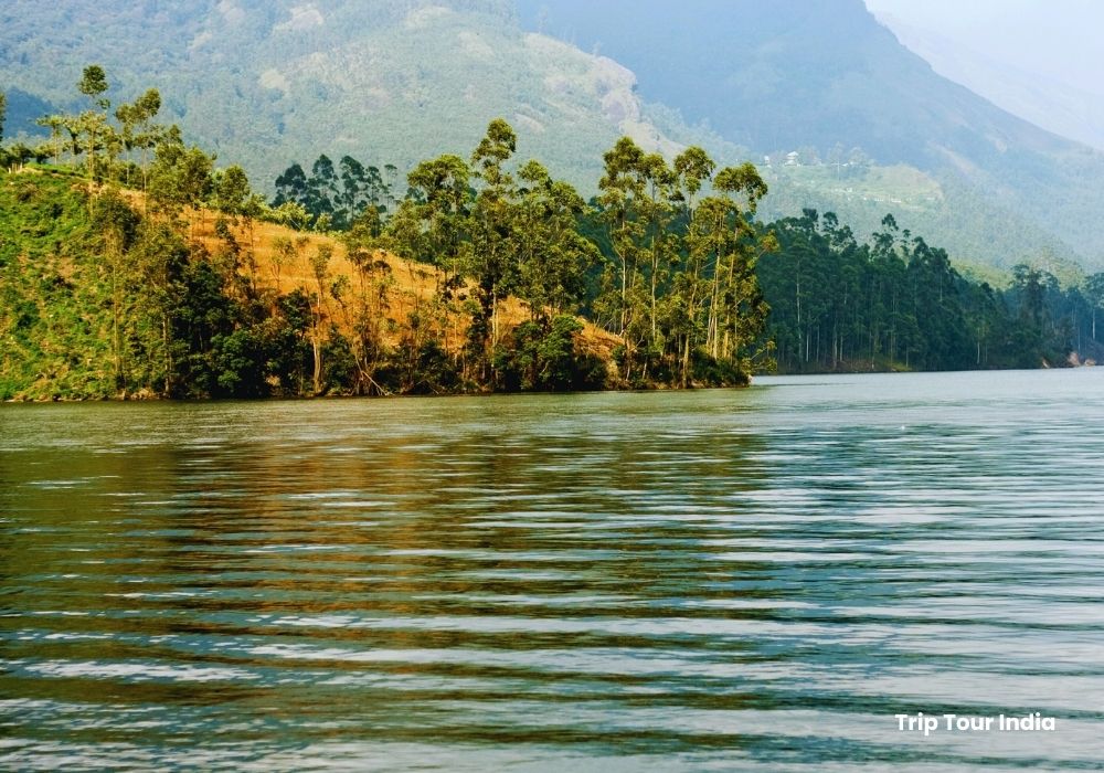
The Periyar Lake within the reserve was formed after the construction of the Mullaperiyar Dam and remains a major tourist attraction.
Hydroelectric & Irrigation Importance
Periyar River is central to Kerala’s energy and water security.
Key dams built on the river include:
- Mullaperiyar Dam – Built in 1895 during British rule
- Idukki Dam – One of India’s highest arch dams
- Edamalayar Dam
These dams support:
- Hydroelectric power generation
- Irrigation for agriculture
- Drinking water supply to cities like Kochi
- Flood control
Tourism Along Periyar River
The river basin is home to some of Kerala’s most beautiful tourist destinations:
🌄 Thekkady
Located near Periyar National Park, Thekkady is known for wildlife safaris, spice plantations, and eco-tourism experiences.
🌊 Periyar Lake
A scenic lake offering boating experiences with opportunities to spot wildlife along the shoreline.
🌴 Aluva & Kochi Region
In its lower course, the river flows through Aluva and near Kochi, where it supports local livelihoods and cultural traditions.
Cultural and Historical Significance
Periyar River has deep cultural roots in Kerala’s history. It has:
- Supported ancient trade routes
- Played a role in temple rituals and festivals
- Influenced settlement patterns across central Kerala
The riverbanks host several temples and religious centers, making it spiritually significant as well.
Environmental Significance
Periyar River supports:
- Wetland ecosystems
- Mangrove forests
- Agricultural fields
- Drinking water reservoirs
However, like many rivers, it faces challenges such as pollution, sand mining, and industrial discharge. Conservation efforts and eco-tourism initiatives are ongoing to protect its fragile ecosystem.
How to Reach Periyar Region
- Nearest Airport: Cochin International Airport (for lower basin)
- Nearest Major Town for Wildlife Tourism: Thekkady
- Well connected by road from Kochi, Madurai, and Munnar
Best Time to Visit
- October to March: Ideal for wildlife spotting and pleasant weather
- Monsoon (June–September): Lush greenery and full-flowing river
- Summer (April–May): Good for animal sightings near water sources
Quick Facts
- Length: Approx. 244 km
- State: Kerala
- Origin: Western Ghats
- Major Use: Hydroelectric power & irrigation
- Known As: “Lifeline of Kerala”
Why Periyar River is Important
- 🌊 Longest river in Kerala
- 🐅 Home to Periyar Tiger Reserve
- ⚡ Major source of hydroelectric power
- 🌾 Supports agriculture and drinking water
- 🏞 Scenic eco-tourism destination
Leave a Reply