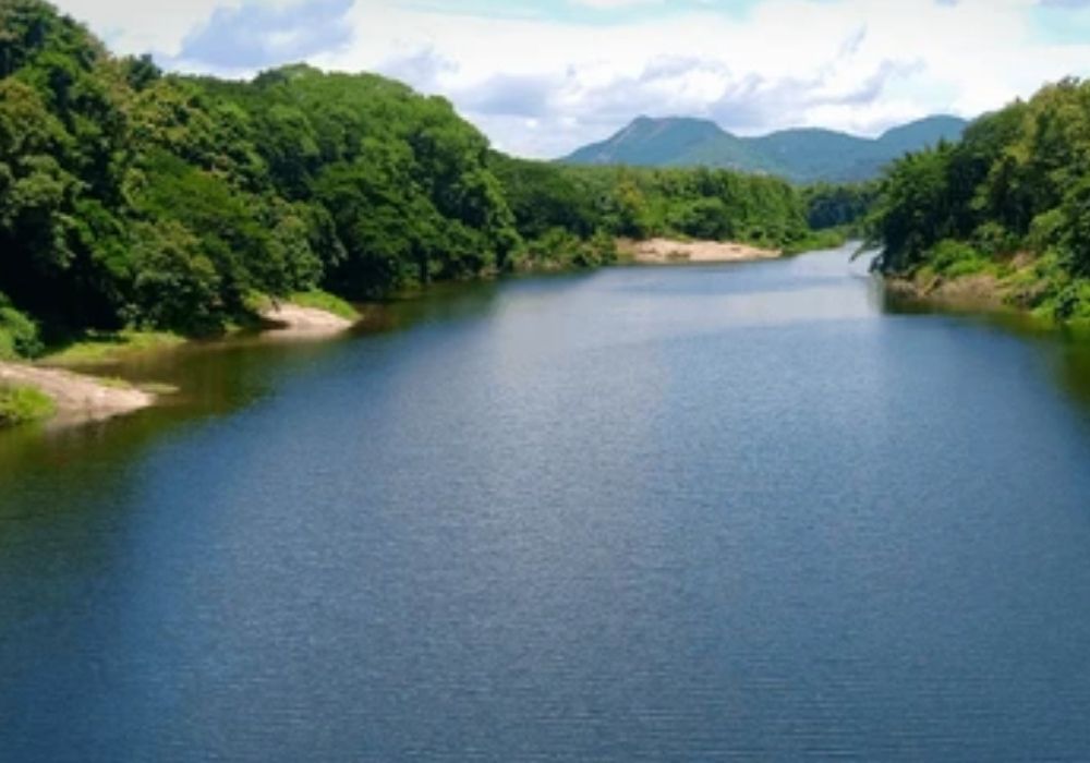
Chaliyar River is one of the major rivers flowing through northern Kerala. Known for its scenic landscapes, historical trade importance, and ecological significance, the Chaliyar River plays a crucial role in the districts of Wayanad, Malappuram, and Kozhikode.
Stretching approximately 169 kilometers, Chaliyar originates in the Western Ghats and flows westward before merging into the Arabian Sea near Beypore.
Unlike some heavily commercialized river systems, Chaliyar retains much of its natural charm, making it an important river for both livelihood and regional heritage.
Origin and Course
The Chaliyar River originates in the forested slopes of the Western Ghats near the Karnataka–Kerala border. It flows through:
- Wayanad (hill region)
- Nilambur (forested area)
- Malappuram district
- Kozhikode district
The river finally drains into the Arabian Sea near Beypore, a historic port town.
Major tributaries include:
- Punnapuzha
- Pandipuzha
- Karimpuzha
- Cherupuzha
Nilambur – The Forest Connection
One of the most important towns along Chaliyar is Nilambur, known for:
- Teak plantations
- Dense forests
- Rich biodiversity
- Eco-tourism activities
Nilambur’s forests are among the oldest teak plantations in the world, and the Chaliyar River sustains this lush green ecosystem.
Historical & Trade Importance
Chaliyar River historically served as a key transportation route for timber trade, especially during the British period. Timber from Nilambur forests was floated downstream to Beypore Port for export.
The river mouth at Beypore is famous for:
- Traditional shipbuilding (Uru boats)
- Maritime trade history
- Cultural exchange with Arabian traders
Ecological Significance
The Chaliyar basin supports:
- Riverine forests
- Wetland ecosystems
- Agricultural lands
- Fishing communities
It plays a major role in irrigation and supports rural livelihoods across Malappuram and Kozhikode districts.
However, the river has faced environmental challenges such as:
- Industrial pollution (historically)
- Sand mining
- Deforestation in upper catchment areas
Sustainable conservation measures are being implemented to protect its biodiversity.
Tourism & Attractions Along Chaliyar River
🌄 Wayanad Region
The upper course near Wayanad offers scenic views, waterfalls, and trekking trails.
🌳 Nilambur Teak Museum
Located near the river, the Nilambur Teak Museum showcases the history of teak cultivation and forestry research in Kerala.
🏖 Beypore Beach
Near the river’s mouth, Beypore Beach provides a serene coastal experience with views of where the river meets the sea.
Agriculture & Livelihood
The fertile banks of Chaliyar support:
- Coconut farming
- Banana plantations
- Paddy fields
- Fishing activities
Local communities depend heavily on the river for water supply and irrigation.
How to Reach
- Nearest Airport: Calicut International Airport
- Nearest Railway Stations: Kozhikode, Nilambur Road
- Well connected by road from Wayanad, Kozhikode, and Malappuram
Best Time to Visit
- October to March: Pleasant weather and ideal for sightseeing
- Monsoon (June–September): River flows fuller, scenic landscapes
- Summer: Moderate temperatures in upper regions
Quick Facts
- Length: Approx. 169 km
- State: Kerala
- Origin: Western Ghats
- Mouth: Arabian Sea at Beypore
- Key Town: Nilambur
Why Chaliyar River is Important
- 🌊 Major river of North Kerala
- 🌴 Supports Nilambur teak forests
- ⚓ Historic timber trade route
- 🌾 Vital for agriculture and irrigation
- 🏞 Ideal for eco-tourism and heritage exploration
Leave a Reply